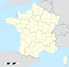
Batschwiller ìm Loch
Erscheinungsbild
(Nochgschiggd worre vun Batschwiller ím Loch)
| Batschwiller | |
|---|---|
|
| |
 | |
 | |
| Verwaltung | |
| Land |
|
| Region |
|
| Département | Bas-Rhin (67) |
| Arrondissement | Sélestat-Erstein |
| Kanton | Ewernahn |
| Kommunalverband | Pays de Barr |
| Maire | Hugues Petit (2014-2020)[1] |
| Code Insee |
67032 |
| Boschtlaitzahl |
67140 |
| Aiwohner | |
| Aiwohner | 202 |
| Flech | 2,76 km2 |
| Bevelkerungsdicht | 75 Iiw./km2 |
| Lach | |
| Koordinate | 48° 22′ 12″ N, 7° 24′ 05″ E / 48.37°N,7.4013888888889°EKoordinate: 48° 22′ 12″ N, 7° 24′ 05″ E / 48.37°N,7.4013888888889°E |
| Hech | 295 m |
| Website | |
| https://www.commune-de-bernardville.fr | |
Batschwiller ìm Loch (franzesisch Bernardvillé, daitsch Bernhardsweiler) isch e franzesische Gemää im Département Bas-Rhin (Unnaelsass) in de Rechion Grand Est (bis 2015 Elsass).
D Gemää gheat zum Kanton Ewernahn im Arrondissement Sélestat-Erstein.
Verwaltung
[Schaffe | Om Gwelltegschd schaffe]De Maire vun Batschwiller isch de Hugues Petit. Batschwiller gheat zum Kommunalvaband Pays de Barr.
Bevelkerungsentwicklung
[Schaffe | Om Gwelltegschd schaffe]| Johr | 1975 | 1982 | 1990 | 1999 | 2008 |
| Aiwohner | 188 | 146 | 187 | 199 | 212 |
Dialekt
[Schaffe | Om Gwelltegschd schaffe]De elsässisch Dialekt vun Batschwiller gheat zum Owerrhaialemannisch.
Weblinks
[Schaffe | Om Gwelltegschd schaffe]Fußnote
[Schaffe | Om Gwelltegschd schaffe]- ↑ (franzesisch) Liste des maires au 25 avril 2014 (data.gouv.fr)
Àndlöi | Apfig | Äschhoffe | Bàrr | Batschwiller | Batschwiller | Bleschwiller | Burige | Dàmbàch | Ewernahn | Gertwiller | Gogschwiller | Heljestään | Hoowàld | Itterschwiller | Krüterrische | Mäischterze | Mìttelbarige | Nìdernahn | Nuutelt | Risfald | Sampeeter | Stotze | Vàlf | Zallwiller

