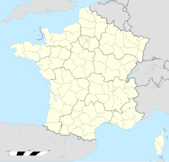
Retschwiller
| Retschwiller | |
|---|---|
|
| |
 | |
 | |
| Verwaltung | |
| Land |
|
| Region |
|
| Département | Bas-Rhin (67) |
| Arrondissement | Haguenau-Wissembourg |
| Kanton | Waisseburch |
| Kommunalverband | Outre-Forêt |
| Maire | Charles Graf (2014-2020)[1] |
| Code Insee |
67394 |
| Boschtlaitzahl |
67250 |
| Aiwohner | |
| Aiwohner | 275 |
| Flech | 3,26 km2 |
| Bevelkerungsdicht | 74,85 Iiw./km2 |
| Lach | |
| Koordinate | 48° 57′ 00″ N, 7° 52′ 45″ E / 48.95°N,7.8791666666667°EKoordinate: 48° 57′ 00″ N, 7° 52′ 45″ E / 48.95°N,7.8791666666667°E |
| Hech | 195 m |
| Website | |
| https://www.retschwiller.fr | |
Retschwiller (franzesisch Retschwiller, daitsch Retschweiler) isch e franzesische Gemää im Département Bas-Rhin (Unnaelsass) in de Rechion Grand Est (bis 2015 Elsass).
D Gemää gheat zum Kanton Waisseburch im Arrondissement Haguenau-Wissembourg.
Verwaltung
[Schaffe | Om Gwelltegschd schaffe]De Maire vun Retschwiller isch de Charles Graf. Retschwiller gheat zum Kommunalvaband Outre-Forêt.
Bevelkerungsentwicklung
[Schaffe | Om Gwelltegschd schaffe]| Johr | 1975 | 1982 | 1990 | 1999 | 2008 |
| Aiwohner | 231 | 200 | 234 | 253 | 255 |
Dialekt
[Schaffe | Om Gwelltegschd schaffe]De elsässisch Dialekt vun Retschwiller gheat zum Owerrhaialemannisch.
Fußnote
[Schaffe | Om Gwelltegschd schaffe]- ↑ (franzesisch) Liste des maires au 25 avril 2014 (data.gouv.fr)
Àschbàch | Äwerbàch | Bänem | Batschdorf | Bihl | Dràchebrunn-Bìrlebach | Drimbàch | Hàtte | Hoffe | Hunschpàch | Ìngelse | Keffenàch | Kesseldorf | Kleeburi | Klimbàch | Krappere | Lüterburi | Mammelshoffe | Minichhause | Modere | Nawiller | Niderlauterbach | Nìderreddere | Owerhoffe | Owerlauterbàch | Owerreddere | Retschwiller | Ridselz | Ritterschoffe | Rott | Sàlembàch | Schàffhöise | Schaiwert | Scheeneburi | Schlatel | Seebàch | Selz | Sije | Stanselz | Stundwiller | Sulz | Sürburi | Waisseburch | Wìnzebàch

