Wìttre
Erscheinungsbild
(Nochgschiggd worre vun Wíttre)
| Wìttre | |
|---|---|
|
| |
 | |
 | |
| Verwaltung | |
| Land |
|
| Region |
|
| Département | Bas-Rhin (67) |
| Arrondissement | Sélestat-Erstein |
| Kanton | Eerstain |
| Kommunalverband | Canton d'Erstein |
| Maire | Philippe Braun (2014-2020)[1] |
| Code Insee |
67545 |
| Boschtlaitzahl |
67230 |
| Aiwohner | |
| Aiwohner | 498 |
| Flech | 4,99 km2 |
| Bevelkerungsdicht | 105,01 Iiw./km2 |
| Lach | |
| Koordinate | 48° 18′ 50″ N, 7° 36′ 44″ E / 48.313888888889°N,7.6122222222222°EKoordinate: 48° 18′ 50″ N, 7° 36′ 44″ E / 48.313888888889°N,7.6122222222222°E |
| Hech | 160 m |
| Website | |
| https://witternheim.fr | |
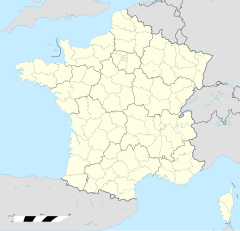
Wìttre (franzesisch Witternheim, daitsch Witternheim) isch e franzesische Gemää im Département Bas-Rhin (Unnaelsass) in de Rechion Grand Est (bis 2015 Elsass).
D Gemää gheat zum Kanton Eerstain im Arrondissement Sélestat-Erstein.
Verwaltung
[Schaffe | Om Gwelltegschd schaffe]De Maire vun Wìttre isch de Philippe Braun. Wìttre gheat zum Kommunalvaband Canton d'Erstein.
Bevelkerungsentwicklung
[Schaffe | Om Gwelltegschd schaffe]| 1793 | 1800 | 1806 | 1821 | 1831 | 1836 | 1841 | 1846 | 1851 | 1856 | 1861 | 1866 |
|---|---|---|---|---|---|---|---|---|---|---|---|
| 223 | 241 | 288 | 315 | 427 | 420 | 414 | 393 | 430 | 442 | 450 | 475 |
| 1871 | 1875 | 1880 | 1885 | 1890 | 1895 | 1900 | 1905 | 1910 | 1921 | 1926 | 1931 |
| 454 | 410 | 398 | 396 | 399 | 402 | 432 | 412 | 390 | 352 | 346 | 378 |
| 1936 | 1946 | 1954 | 1962 | 1968 | 1975 | 1982 | 1990 | 1999 | 2005 | 2010 | 2012 |
| 360 | 331 | 322 | 340 | 316 | 274 | 353 | 386 | 382 | 497 | 510 | 517 |
Dialekt
[Schaffe | Om Gwelltegschd schaffe]De elsässisch Dialekt vun Wìttre gheat zum Owerrhaialemannisch.
Weblinks
[Schaffe | Om Gwelltegschd schaffe]Fußnote
[Schaffe | Om Gwelltegschd schaffe]- ↑ (franzesisch) Liste des maires au 25 avril 2014 (data.gouv.fr)
- ↑ cassini.ehess.fr

