Büschwìller
| Büschwìller | |
|---|---|
|
| |
 | |
 | |
| Verwaltung | |
| Land |
|
| Region |
|
| Département | Haut-Rhin (68) |
| Arrondissement | Mulhouse |
| Kanton | Saint-Louis |
| Kommunalverband | Saint-Louis Agglomération |
| Amtlicha Name | Buschwiller |
| Maire | Christèle Willer (2014-2020)[1] |
| Code Insee |
68061 |
| Boschtlaitzahl |
68220 |
| Aiwohner | |
| Aiwohner | 1.053 |
| Flech | 4,16 km2 |
| Bevelkerungsdicht | 228,37 Iiw./km2 |
| Lach | |
| Koordinate | 47° 33′ 30″ N, 7° 30′ 27″ E / 47.558333333333°N,7.5075°EKoordinate: 47° 33′ 30″ N, 7° 30′ 27″ E / 47.558333333333°N,7.5075°E |
| Hech | 308 m |
| Website | |
| http://www.buschwiller.fr | |
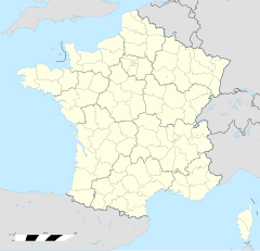
Büschwìller (franzesisch Buschwiller, daitsch Buschweiler) isch e franzesische Gemää im Département Haut-Rhin (Owwaelsass) in de Rechion Grand Est (bis 2015 Elsass).
D Gemää gheat zum Kanton Saint-Louis un zum Arrondissement Mulhouse.
Geografie
[Schaffe | Om Gwelltegschd schaffe]Büschwìller licht 25 km vun Mìlhüüse uf 308 m NN.
Gschicht
[Schaffe | Om Gwelltegschd schaffe]Büschwìller isch im Johr 1096 zum easchte Mol gnennt worre.
Verwaltung
[Schaffe | Om Gwelltegschd schaffe]D Maire vun Büschwìller isch d Christèle Willer. Büschwìller gheat zum Kommunalvaband Saint-Louis Agglomération.
Bevelkerungsentwicklung
[Schaffe | Om Gwelltegschd schaffe]| Johr | 1968 | 1975 | 1982 | 1990 | 1999 | 2008 |
| Aiwohner | 607 | 762 | 759 | 767 | 881 | 942 |
Dialekt
[Schaffe | Om Gwelltegschd schaffe]De elsässisch Dialekt vun Büschwìller gheat zum Hochalemannisch.
Weblinks
[Schaffe | Om Gwelltegschd schaffe]Fußnote
[Schaffe | Om Gwelltegschd schaffe]- ↑ (franzesisch) Liste des maires au 25 avril 2014 (data.gouv.fr)
Àtteschwìller | Blohze | Büschwìller | Folgeschburg | Hagene | Häsige | Hìnige | Knehrige | Layme | Liebedswìller | Näiwil | Neidorf | Nìderhàgethàl | Nìderraischbe | Niedermìchelbe | Oberhàgethàl | Obermìchelbe | Oberraispe | Rosenöi | Saint-Louis | Wanzwìller |

