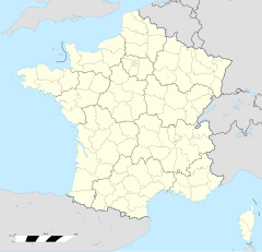
Gunderschoffe
| Gunderschoffe | |
|---|---|
|
| |
 | |
 | |
| Verwaltung | |
| Land |
|
| Region |
|
| Département | Bas-Rhin (67) |
| Arrondissement | Haguenau-Wissembourg |
| Kanton | Risshoffe |
| Kommunalverband | Pays de Niederbronn-les-Bains |
| Maire | Claude Muckensturm (2014-2020)[1] |
| Code Insee |
67176 |
| Boschtlaitzahl |
67110 |
| Aiwohner | |
| Aiwohner | 3.779 |
| Flech | 17,55 km2 |
| Bevelkerungsdicht | 197,04 Iiw./km2 |
| Lach | |
| Koordinate | 48° 54′ 20″ N, 7° 39′ 47″ E / 48.905555555556°N,7.6630555555556°EKoordinate: 48° 54′ 20″ N, 7° 39′ 47″ E / 48.905555555556°N,7.6630555555556°E |
| Hech | 185 m |
| Website | |
| http://www.gundershoffen.fr | |
Gunderschoffe (franzesisch Gundershoffen, daitsch Gundershofen) isch e franzesische Gemää im Département Bas-Rhin (Unnaelsass) in de Rechion Grand Est (bis 2015 Elsass).
D Gemää gheat zum Kanton Risshoffe im Arrondissement Haguenau-Wissembourg.
Verwaltung
[Schaffe | Om Gwelltegschd schaffe]De Maire vun Gunderschoffe isch de Claude Muckensturm. Gunderschoffe gheat zum Kommunalvaband Pays de Niederbronn-les-Bains.
Bevelkerungsentwicklung
[Schaffe | Om Gwelltegschd schaffe]| Johr | 1975 | 1982 | 1990 | 1999 | 2008 |
| Aiwohner | 2.738 | 3.261 | 3.377 | 3.490 | 3.454 |
Dialekt
[Schaffe | Om Gwelltegschd schaffe]De elsässisch Dialekt vun Gunderschoffe gheat zum Owerrhaialemannisch.
Weblinks
[Schaffe | Om Gwelltegschd schaffe]Fußnote
[Schaffe | Om Gwelltegschd schaffe]- ↑ (franzesisch) Liste des maires au 25 avril 2014 (data.gouv.fr)
Angwìller | Bìtschoffe | Bìwelse | Dàmbàch | Diefebàch | Dìrrebàch | Eschbàch | Forschem | Freschwiller | Gerschdorf | Gumbertshoffe | Gunderschoffe | Gunschtett | Hajenai | Kìndwìller | Kutzehüse | Lämbàch | Làmpertschloch | Làngesulzbàch | Laubàch | Lüsann | Merikwiller-Beschelbrunn | Merzwiller | Mietsem | Morschbrunn | Nìderbrunn | Nìdermodere | Nìderstanbach | Offwìller | Örwìller | Ötehoffe | Owerbrunn | Owerdorf-Spàchbàch | Owerstanbach | Prischdorf | Risshoffe | Ruubach | Val de Moder | Wàlburi | Werth | Wìndstain | Wìnge | Zìnswìller

