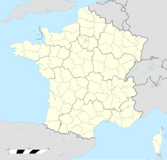
Harreberg
Erscheinungsbild
| Harreberg | |
|---|---|
|
| |
 | |
 | |
| Verwaltung | |
| Land |
|
| Region |
|
| Département | Moselle (57) |
| Arrondissement | Sarrebourg |
| Kanton | Phalsbourg |
| Kommunalverband | Sarrebourg Moselle Sud |
| Maire | Antoine Schott (2014-2020)[1] |
| Code Insee |
57298 |
| Boschtlaitzahl |
57870 |
| Aiwohner | |
| Aiwohner | 371 |
| Flech | 6,34 km2 |
| Bevelkerungsdicht | 60,25 Iiw./km2 |
| Lach | |
| Koordinate | 48° 39′ 57″ N, 7° 10′ 13″ E / 48.665833333333°N,7.1702777777778°EKoordinate: 48° 39′ 57″ N, 7° 10′ 13″ E / 48.665833333333°N,7.1702777777778°E |
| Hech | 420 m |
Harreberg (lothr. Hoerberj, daitsch Haarberg) ìsch e franzesische Gemää im Département Moselle in de Rechion Grand Est (bis 2015 Rechion Lothringe).
D Gemää gheat zum Kanton Phalsbourg im Arrondissement Sarrebourg.
Verwaltung
[Schaffe | Om Gwelltegschd schaffe]De Maire vun Harreberg isch de Antoine Schott. Harreberg gheat zum Kommunalvaband Sarrebourg Moselle Sud.
Bevelkerungsentwicklung
[Schaffe | Om Gwelltegschd schaffe]| Johr | 1968 | 1975 | 1982 | 1990 | 1999 | 2008 |
| Aiwohner | 326 | 333 | 340 | 369 | 352 | 385 |
Dialekt
[Schaffe | Om Gwelltegschd schaffe]De lothringisch Dialekt vun Harreberg gheat zum Rhaifränkisch.
Fußnote
[Schaffe | Om Gwelltegschd schaffe]- ↑ (franzesisch) Liste des maires au 25 avril 2014 (data.gouv.fr)
Barchain | Bébing | Brouderdorff | Buhl-Lorraine | Diane-Capelle | Harreberg | Hartzviller | Haut-Clocher | Hesse (Moselle) | Hommarting | Hommert | Imling | Kerprich-aux-Bois | Langatte | Niderviller | Plaine-de-Walsch | Réding | Rhodes (Moselle) | Sarrebourg | Schneckenbusch | Troisfontaines | Walscheid | Xouaxange

