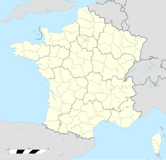
Le Val-de-Guéblange
| Le Val-de-Guéblange | |
|---|---|
|
| |
 | |
 | |
| Verwaltung | |
| Land |
|
| Region |
|
| Département | Moselle (57) |
| Arrondissement | Sarreguemines |
| Kanton | Sarralbe |
| Kommunalverband | Sarreguemines Confluences |
| Maire | Sonia Bour Bur (2014-2020)[1] |
| Code Insee |
57267 |
| Boschtlaitzahl |
57430 |
| Aiwohner | |
| Aiwohner | 815 |
| Flech | 19,08 km2 |
| Bevelkerungsdicht | 45,91 Iiw./km2 |
| Lach | |
| Koordinate | 48° 58′ 46″ N, 6° 57′ 39″ E / 48.979444444444°N,6.9608333333333°EKoordinate: 48° 58′ 46″ N, 6° 57′ 39″ E / 48.979444444444°N,6.9608333333333°E |
| Hech | 220 m |
Le Val-de-Guéblange (daitsch Geblingen) ìsch e franzesische Gemää im Département Moselle in de Rechion Grand Est (bis 2015 Rechion Lothringe).
D Gemää gheat zum Kanton Sarralbe im Arrondissement Sarreguemines.
Verwaltung[Schaffe | Om Gwelltegschd schaffe]
D Maire vun Le Val-de-Guéblange isch d Sonia Bour Bur. Le Val-de-Guéblange gheat zum Kommunalvaband Sarreguemines Confluences.
Bevelkerungsentwicklung[Schaffe | Om Gwelltegschd schaffe]
| Johr | 1968 | 1975 | 1982 | 1990 | 1999 | 2008 |
| Aiwohner | 977 | 383 | 375 | 395 | 392 | 477 |
Dialekt[Schaffe | Om Gwelltegschd schaffe]
De lothringisch Dialekt vun Le Val-de-Guéblange gheat zum Rhaifränkisch.
Weblinks[Schaffe | Om Gwelltegschd schaffe]
Fußnote[Schaffe | Om Gwelltegschd schaffe]
- ↑ (franzesisch) Liste des maires au 25 avril 2014 (data.gouv.fr)
Normdate: VIAF: 26144648219028314874

