Lostroff
Erscheinungsbild
| Lostroff | |
|---|---|
|
| |
 | |
 | |
| Verwaltung | |
| Land |
|
| Region |
|
| Département | Moselle (57) |
| Arrondissement | Sarrebourg |
| Kanton | Le Saulnois |
| Kommunalverband | Saulnois |
| Maire | Christian Mertel (2014-2020)[1] |
| Code Insee |
57417 |
| Boschtlaitzahl |
57670 |
| Aiwohner | |
| Aiwohner | 70 |
| Flech | 4,96 km2 |
| Bevelkerungsdicht | 15,52 Iiw./km2 |
| Lach | |
| Koordinate | 48° 51′ 32″ N, 6° 51′ 11″ E / 48.858888888889°N,6.8530555555556°EKoordinate: 48° 51′ 32″ N, 6° 51′ 11″ E / 48.858888888889°N,6.8530555555556°E |
| Hech | 240 m |
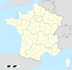
Lostroff (daitsch Losdorf) ìsch e franzesische Gemää im Département Moselle in de Rechion Grand Est (bis 2015 Rechion Lothringe).
D Gemää gheat zum Kanton Le Saulnois im Arrondissement Sarrebourg.
Verwaltung
[Schaffe | Om Gwelltegschd schaffe]De Maire vun Lostroff isch de Christian Mertel. Lostroff gheat zum Kommunalvaband Saulnois.
Bevelkerungsentwicklung
[Schaffe | Om Gwelltegschd schaffe]| Johr | 1968 | 1975 | 1982 | 1990 | 1999 | 2008 |
| Aiwohner | 75 | 77 | 72 | 76 | 83 | 77 |
Dialekt
[Schaffe | Om Gwelltegschd schaffe]De draditionell Dialekt (Patois) vun Lostroff gheat zum Lorrain.
Fußnote
[Schaffe | Om Gwelltegschd schaffe]- ↑ (franzesisch) Liste des maires au 25 avril 2014 (data.gouv.fr)
Albestroff | Bénestroff | Bermering | Francaltroff | Givrycourt | Guinzeling | Honskirch | Insming | Insviller | Léning | Lhor | Lostroff | Loudrefing | Marimont-lès-Bénestroff | Molring | Montdidier (Moselle) | Munster (Moselle) | Nébing | Neufvillage | Réning | Rodalbe | Torcheville | Vahl-lès-Bénestroff | Vibersviller | Virming | Vittersbourg

