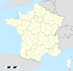
Loupershouse
Erscheinungsbild
| Loupershouse | |
|---|---|
|
| |
 | |
 | |
| Verwaltung | |
| Land |
|
| Region |
|
| Département | Moselle (57) |
| Arrondissement | Sarreguemines |
| Kanton | Sarralbe |
| Kommunalverband | Sarreguemines Confluences |
| Maire | Jean-Claude Kratz (2014-2020)[1] |
| Code Insee |
57419 |
| Boschtlaitzahl |
57510 |
| Aiwohner | |
| Aiwohner | 895 |
| Flech | 7,73 km2 |
| Bevelkerungsdicht | 121,35 Iiw./km2 |
| Lach | |
| Koordinate | 49° 04′ 52″ N, 6° 54′ 49″ E / 49.081111111111°N,6.9136111111111°EKoordinate: 49° 04′ 52″ N, 6° 54′ 49″ E / 49.081111111111°N,6.9136111111111°E |
| Hech | 234 m |
| Website | |
| http://www.loupershouse.fr | |
Loupershouse (daitsch Lupershausen) ìsch e franzesische Gemää im Département Moselle in de Rechion Grand Est (bis 2015 Rechion Lothringe).
D Gemää gheat zum Kanton Sarralbe im Arrondissement Sarreguemines.
Verwaltung
[Schaffe | Om Gwelltegschd schaffe]De Maire vun Loupershouse isch de Jean-Claude Kratz. Loupershouse gheat zum Kommunalvaband Sarreguemines Confluences.
Bevelkerungsentwicklung
[Schaffe | Om Gwelltegschd schaffe]| Johr | 1968 | 1975 | 1982 | 1990 | 1999 | 2008 | 2013 |
| Aiwohner | 776 | 826 | 853 | 850 | 893 | 943 | 967 |
Dialekt
[Schaffe | Om Gwelltegschd schaffe]De lothringisch Dialekt vun Loupershouse gheat zum Rhaifränkisch.
Fußnote
[Schaffe | Om Gwelltegschd schaffe]- ↑ (franzesisch) Liste des maires au 25 avril 2014 (data.gouv.fr)
Bliesbruck | Blies-Ébersing | Blies-Guersviller | Frauenberg | Grosbliederstroff | Grundviller | Guebenhouse | Hombach | Hundling | Ippling | Lixing-lès-Rouhling | Loupershouse | Neufgrange | Rémelfing | Rouhling | Sarreinsming | Wiesviller | Wittring | Wœlfling-lès-Sarreguemines | Woustviller | Zetting
Normdate: VIAF: 242768804

